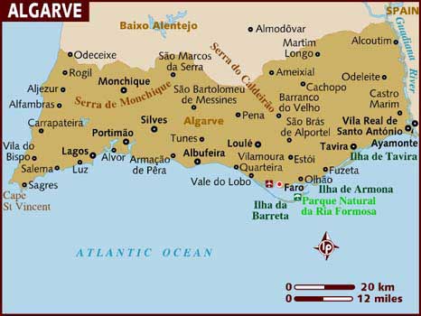
Google Earth Map
Map

Climate
| Jan | Feb | Mar | Apr | May | Jun | Jul | Aug | Sep | Oct | Nov | Dec | |
| Max Temp (oC) | 15 | 16 | 18 | 21 | 24 | 30 | 35 | 37 | 33 | 28 | 19 | 17 |
| Max Temp (oF) | 59 | 61 | 64 | 70 | 75 | 86 | 95 | 99 | 91 | 82 | 66 | 63 |
| Sun (Hours) | 6 | 7 | 7 | 9 | 10 | 12 | 12 | 12 | 9 | 8 | 6 | 6 |
| Sea Temp (oC) | 15 | 15 | 16 | 16 | 17 | 19 | 21 | 21 | 21 | 19 | 17 | 15 |
| Max oC | Max oF | Sun hrs | Sea oC | |
| Jan | 15 | 59 | 6 | 15 |
| Feb | 16 | 61 | 7 | 15 |
| Mar | 18 | 64 | 7 | 16 |
| Apr | 21 | 70 | 9 | 16 |
| May | 24 | 75 | 10 | 17 |
| Jun | 30 | 86 | 12 | 19 |
| Jul | 35 | 95 | 12 | 21 |
| Aug | 37 | 99 | 12 | 21 |
| Sep | 33 | 91 | 9 | 21 |
| Oct | 28 | 82 | 8 | 19 |
| Nov | 19 | 66 | 6 | 17 |
| Dec | 17 | 63 | 6 | 15 |
The climate in the Western Algarve is typically Mediterranean with hot, dry summers and mild, wet winters. In the summer months, the heat (which can sometimes reach a high of nearly 40 degrees Celsius in August) is eased by cooling north-westerly Atlantic winds. Despite these temperatures, humidity is rarely a problem. The driest period is from May until mid-September, with only 6% of the annual rainfall occurring during these months. November to February are usually the wettest months but the rain tends to fall for an hour or so, rather than in a constant drizzle. Even in the winter it is warm, with an average of six hours of sunshine.

